Desktop software built specifically for North American roofing contractors, insurance adjusters, and estimators. Automatically detect roof planes, pitch slope, ridges, and hips from public USGS & NRCan elevation point clouds.
No generic aerial screenshots. LenRoof Estimator renders raw elevation point clouds and automatically fits planar facets, slopes, hips, and valleys with surgical accuracy.

Stop paying \$40 to \$80 per property for third-party reports. Gain complete control over your measurements and material estimates right on your own computer.
Directly parse high-resolution elevation data from USGS 3DEP (United States) and NRCan / Provincial OpenData (Canada). Automatically clean tree foliage and noise with integrated RANSAC filters.
Automatically calculates true 3D surface area for every slope (e.g. 7/12, 9/12, 12/12). Accounts for pitch multipliers, azimuth orientation, and dormers to eliminate underbidding risks.
LenRoof classifies every roof edge into standard roofing categories: Ridges, Hips, Valleys, Eaves, Rakes, and Step Flashing lines with exact linear footage readouts.
Export professional, branded PDF proposals for homeowners or insurance adjusters. Generate complete Bill of Materials (BOM) including shingle bundles, underlayment rolls, and waste factors.
Runs natively on your Windows PC or Mac. Customer addresses, client proposals, and takeoff calculations stay strictly on your local disk. Never wait in cloud queue during peak storm season.
A contractor estimating 15 roofs a month spends over \$9,000/year on report credits. With LenRoof Estimator, you buy once or subscribe for unlimited estimates with zero per-address fees.
Designed for speed during busy bid cycles. No complex CAD drafting required.
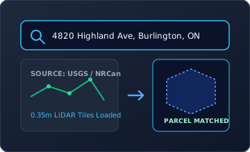
Type any North American address. LenRoof streams public USGS or NRCan LiDAR elevation tiles and matches municipal parcel boundaries automatically.
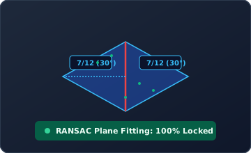
The geometry engine filters out overhanging trees and automatically fits 3D planar facets, pitch slopes (e.g. 7/12), ridges, valleys, and eaves in real time.
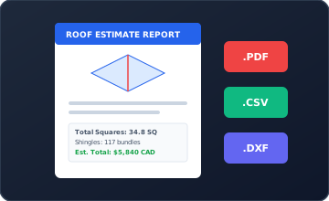
Apply your customized waste allowance factor (e.g. 10%–15%) and instantly generate client-ready PDF proposals and supplier CSV order sheets.
Compare LenRoof Estimator against cloud report services like EagleView or Roofr.
| Feature Comparison | LenRoof Estimator | EagleView / Roofr Reports |
|---|---|---|
| Cost Per Estimate | ✓ $0 (Unlimited Estimates) | ✗ $40 – $80 per property |
| Turnaround Time | ✓ Instant (< 10 seconds) | ✗ 4 hours to 24+ hours wait |
| Data Privacy & Storage | ✓ 100% Local on PC/Mac | ✗ Hosted on third-party cloud |
| Offline Jobsite Operation | ✓ Fully functional offline | ✗ Requires active internet connection |
| Multi-Machine License | ✓ 2 Workstations per license | ✗ Expensive per-seat recurring fees |
| LiDAR Geometry Verification | ✓ Full 3D Interactive Point Cloud | ✗ Static PDF screenshots only |
Clear answers about regional LiDAR coverage, offline usage, and license management.
LenRoof integrates directly with official North American public elevation repositories:
If a specific rural property lacks LiDAR coverage, LenRoof allows you to import drone point clouds (.LAS/.LAZ) or use our manual 2D ortho tracing tool.
Yes! LenRoof is a true native desktop application. Once you cache regional elevation tiles or import your project data, calculations, 3D point cloud inspections, and PDF proposal generation are performed 100% on your laptop's local CPU/GPU without needing an internet connection.
Each standard license grants activation on up to 2 computers simultaneously (for example, your main office desktop PC and your field laptop). You can easily deactivate and transfer your license to a new workstation anytime through the software settings.
LenRoof supports:
We provide an unconditional 14-day money-back guarantee. If the software does not meet your operational requirements or if your primary operating territory lacks adequate LiDAR coverage, simply contact our support team at support@lenroof.com for a full refund, subject to license deactivation.
Download the fully functional 14-day trial or purchase a license to unlock unlimited roof geometry calculations.
